Posts in category 'Why We Love Central Oregon'
Subscribe and receive email notifications of new blog posts.
 RSS Feed
- 2026 | 65 Posts
- 2025 | 103 Posts
- 2024 | 110 Posts
- 2023 | 72 Posts
- 2022 | 52 Posts
- 2021 | 70 Posts
- 2020 | 84 Posts
- 2019 | 38 Posts
- 2018 | 48 Posts
- 2017 | 39 Posts
- 2016 | 31 Posts
- 2015 | 10 Posts
6
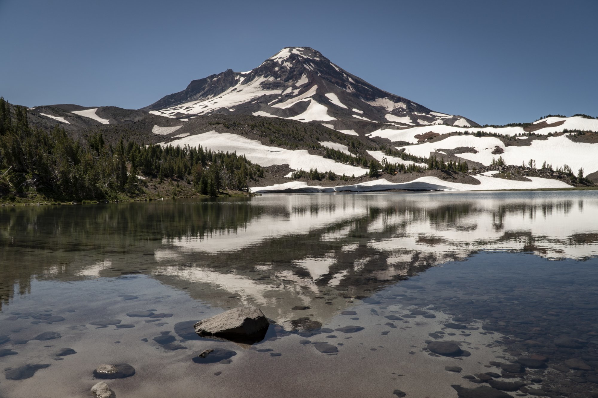
Hike Something Different - Tam McArthur Rim to Broken Top Via Broken Hand

We have hiked to Tam McArthur Rim in the past and we have hiked to Broken Top in the past, but we had never hiked to Broken Top from Tam McArthur Rim until last week. The hike starts at Three Creeks Lake located off Forest Road 16 (Elm Street in Sisters turns into this as you drive out of the city) and is heavily trafficked, rising over 1200 feet over 2.5 miles to the Rim viewpoint. Beautiful views of Three Creeks Lake and many of the Cascades are visible from the rim. Near the end of the initial trail is a sign near another trail heading off toward Broken Top which states "Trail Not Maintained." We decided to take this 2.2 hike to Broken Hand, a rock formation between the Rim and Broken Top. While this hike, much of it in the sun, was initially not that tough, once we approached Broken Hand, the trail got decidedly sketchy with scrambles over and around boulders and loose stones required. To get past Broken Hand, the trail traversed through a snow field. But once past this, a faint trail continued on toward Broken Top and we ended up on the moraine overlooking No Name Lake. This additional distance made for a very full day (and of course we had to travel back to our car at Three Creeks Lake), but the experience and views (10 full Cascade peaks) were fabulous. This hike is not easy and not recommended for all.
 |
 |
|
|

28
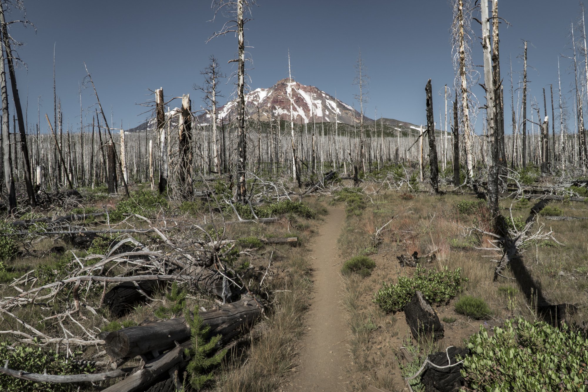
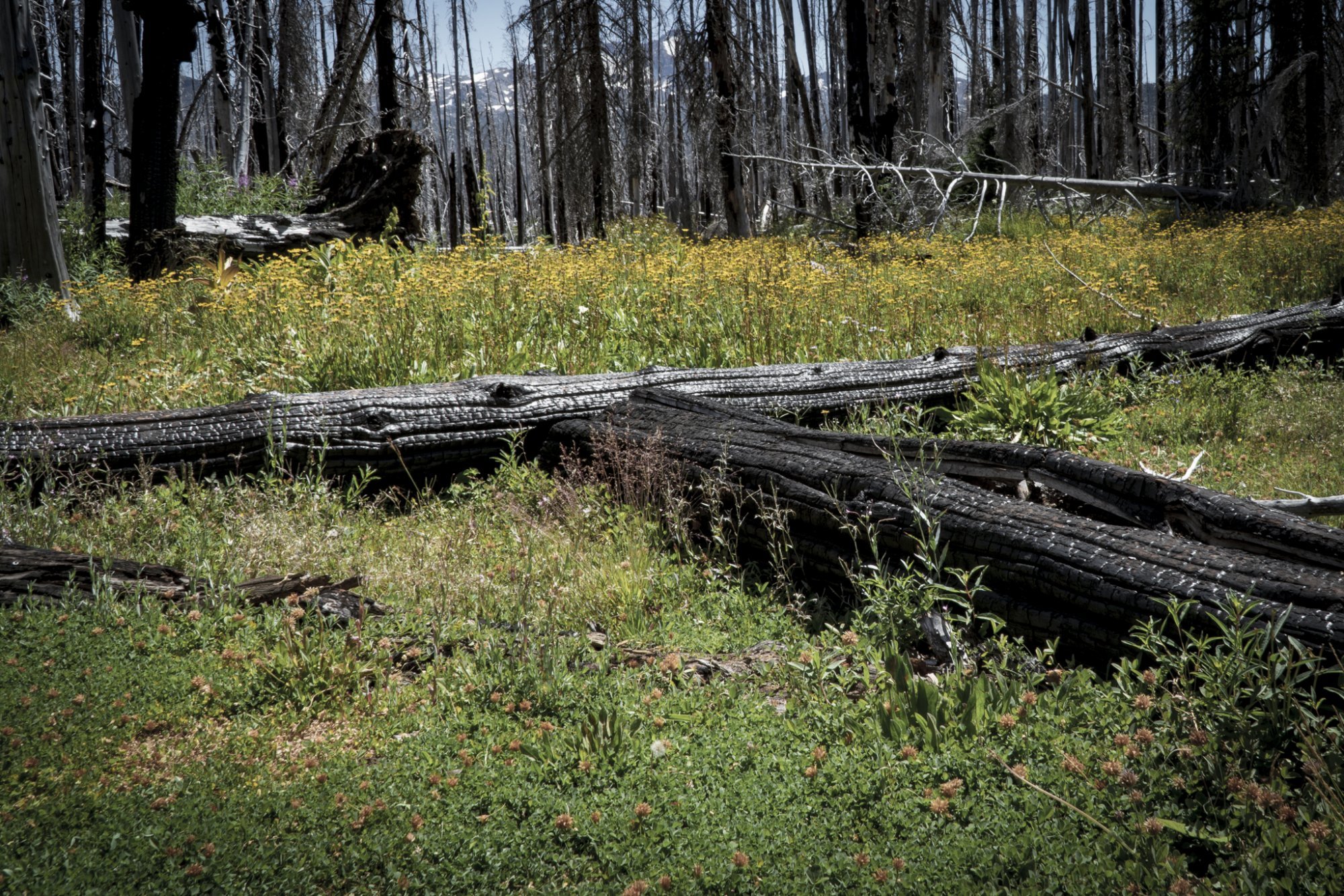
The Hike to Camp Lake in the Three Sisters Wilderness is Full of Surprises
We have lived in Central Oregon since 1985, but during this entire time we have never hiked to Camp Lake. The start of this hike is located just outside Sisters off McKenzie Hwy on Forest Road 15 at the Pole Creek Trailhead. The hike into Camp Lake covers 7.1 miles (14.2 miles round trip), the first 4 through a burned forest, the result of 2017's Milli Fire. However, it is interesting to see how new plant growth is returning in the burned area. And the open areas provide for wonderful views of both Middle and North Sister.
Once we left the burned forest and entered the higher elevations, we had the opportunity to cross the North Fork of Whychus Creek and hike even closer to Middle Sister. Several trails off the main trail lead to the summit of Middle Sister, a hike only for very experienced hikers with recommendations for climbing gear. Our hike left Middle Sister at this point and traveled further southwest to end at Camp Lake, part of the Chambers Lake series of high elevation lakes in the area, at the base of South Sister. Many campers stay in this area - hiking in and enjoying the area before leaving the next day. The elevation change over the 7.1 miles is just shy of 1700 ft (5300 ft at the trailhead to 6980 at Camp Lake), but it is gradual enough that many take this hike, including children. The books call this a difficult hike, but we would call it more moderate - just longer than many other hikes in the area.
 |
 |
 |
20
Tumalo Mountain is Always a Great Central Oregon Hike
Tumalo Mountain is One of the Best Places to View Mt. Bachelor
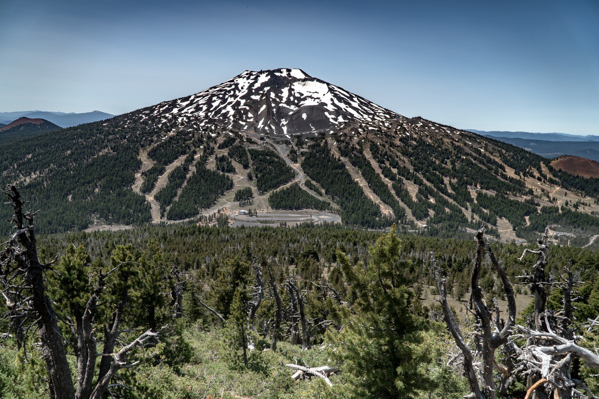
We have hiked Tumalo Mountain several times, but each has experience been enjoyable. The 4 mile round trip has 1400 foot elevation change, so it is fairly steep going up. However, once you reach the top, the views of Mt. Bachelor, South Sister, Broken Top, and east toward the Ochocos are fabulous. During July, the evidence that Mt. Bachelor is a renowned ski area is obvious with the ski runs and maintenance roads visible, but the beauty of the mountain is also easy to see. Tumalo Mountain is a popular hike and plan on seeing people during your trip up and back. Bring plenty of water and enjoy the experience.
 |
 |
17
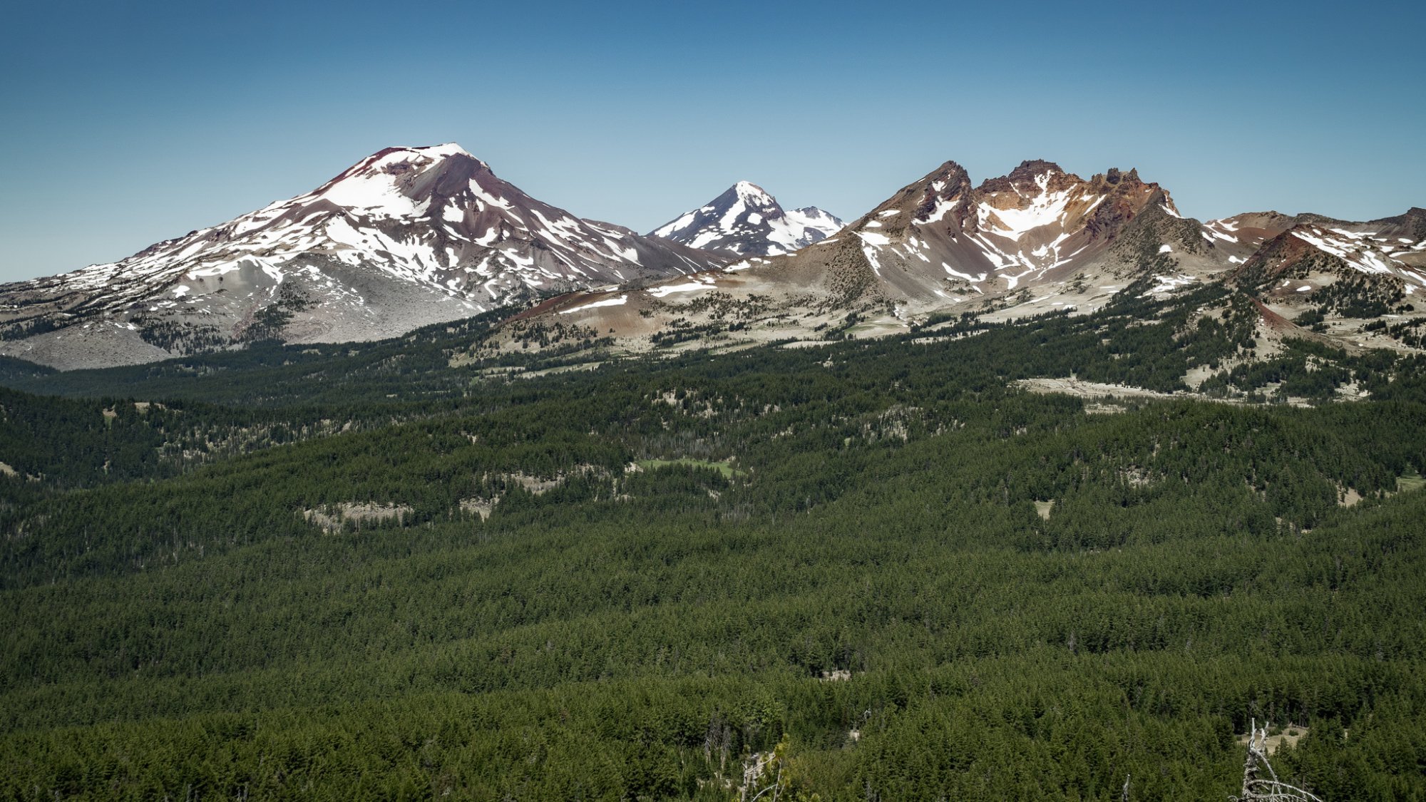
Black Crater Hike Offers Eight Cascade Peaks Views

We had never hiked Black Crater on McKenzie Summit until this month and it turned out to be a wonderful experience. Despite the burned area at the beginning of the hike, the result of the 2017 24,000 acre Millie Fire, the 7 miles up and back was easy enough, although steep in sections, and signs of new life in the burned forest was interesting to see. However, the reason people hike Black Crater is for the views at the top. On our day, July 13, 2020, eight Cascade Mountains were visible. We had to get through about 1/2 mile of snow to reach the top, but once the trail opened up, the stunning vistas of Broken Top, the Three Sisters, Mt. Washington, 3 Fingered Jack, Jefferson and Mt. Hood were all there and we enjoyed seeing them from this wonderful vantage point. Trail books note the hike as "difficult" or "hard," but we found it more moderate than super challenging. The elevation change is there, but if you take your time, the views are very much worth the effort.
 |
 |
 |
 |
7
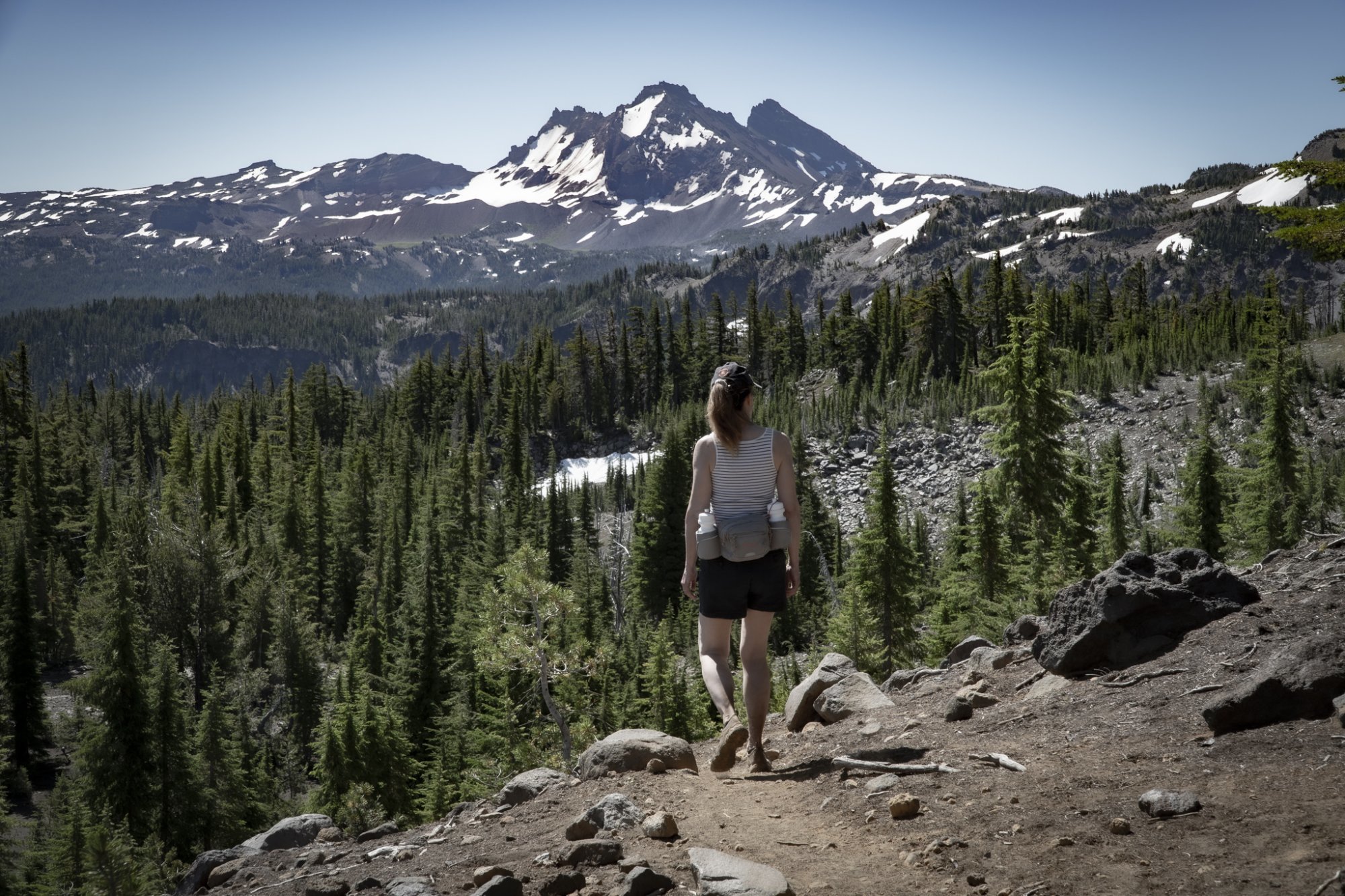
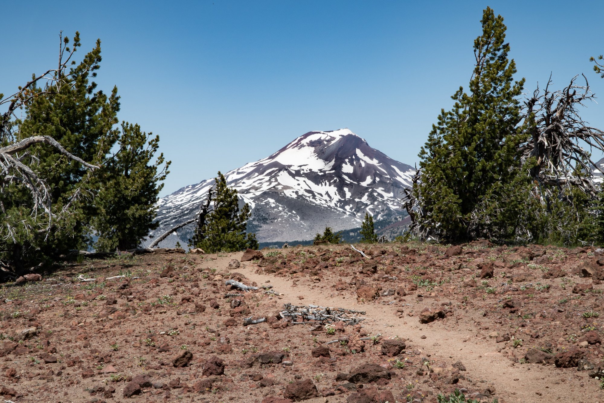
Beyond Green Lakes is Golden Lake in the Three Sisters Wilderness
Golden Lake is a Rarely Visited Site in the Three Sisters Wilderness

We have hiked to Green Lakes many times over the years. The 4.5 miles to the lake posted on the forest service sign by the trail head we believe is to the first lake the trail reaches and not to the far lake which usually takes another 1/2 hour to 45 minutes of hiking. We have gone to the far lake often, but have never gone past that last lake until this year. The trail further into the Three Sisters Wilderness continues past the last Green Lakes, over the creek and up a hill. We decided to travel a short distance on this trail to see what we could find, having checked out a map noting a meadow and Golden Lake.
Most people traveling into the Three Sisters Wilderness will backpack in and camp, but with our early start, we just hiked in and out. Our initial short distance idea expanded a bit, but the hike to Golden Lake was well worth it. The trail led over snow patches, but once we reached the lake, the beauty of the yellow wildflowers, the stunning views of Broken Top, South Sister, Middle Sister and North Sister and the absolute privacy with no one else around was an experience we shall remember for years to come.
 |
 |
 |
 |
 |
 |