Posts with tag 'Why We Love Central Oregon'
Subscribe and receive email notifications of new blog posts.
 RSS Feed
- 2026 | 65 Posts
- 2025 | 103 Posts
- 2024 | 110 Posts
- 2023 | 72 Posts
- 2022 | 52 Posts
- 2021 | 70 Posts
- 2020 | 84 Posts
- 2019 | 38 Posts
- 2018 | 48 Posts
- 2017 | 39 Posts
- 2016 | 31 Posts
- 2015 | 10 Posts
18
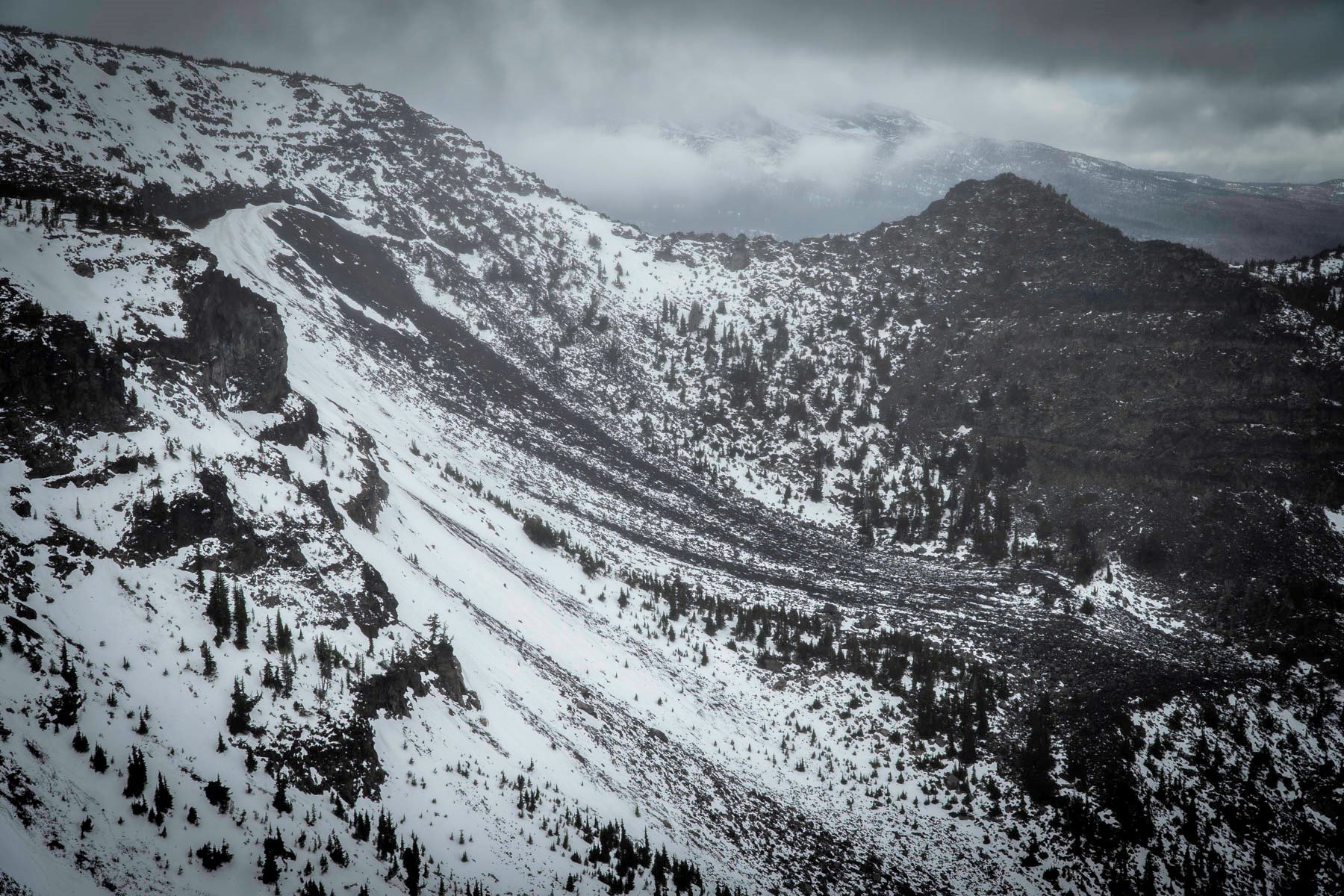
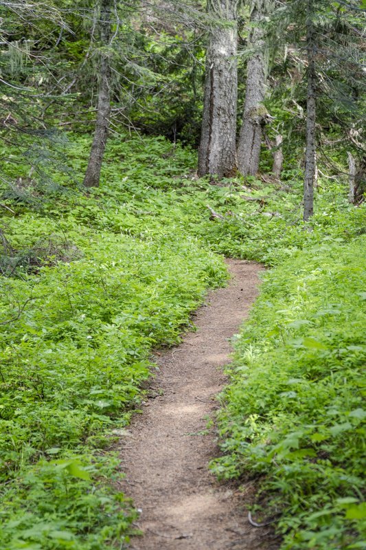
Black Crater Hike is Open in Central Oregon's Three Sisters Wilderness
Black Crater is a Challenging Hike
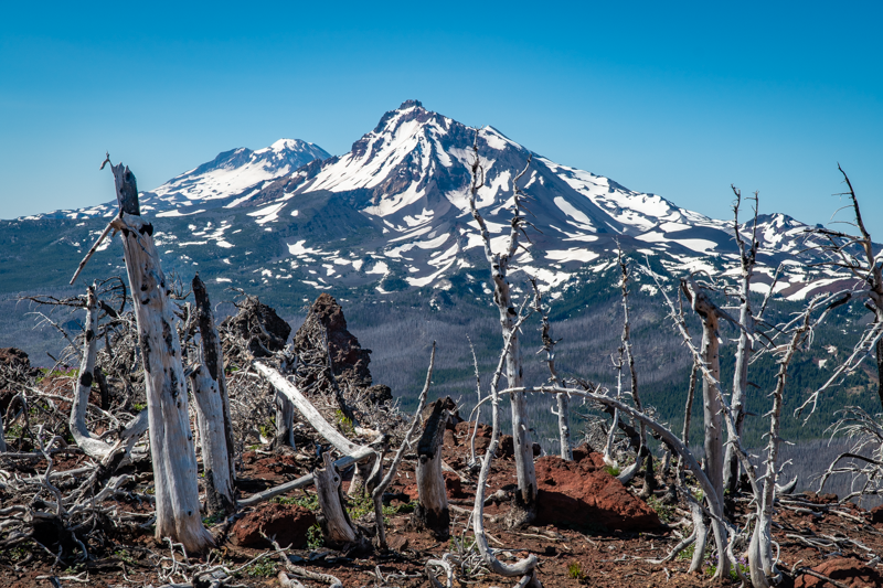
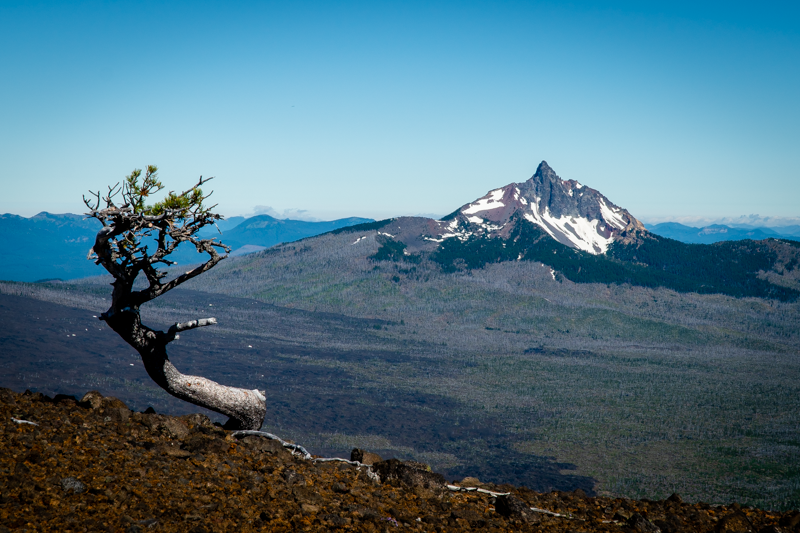
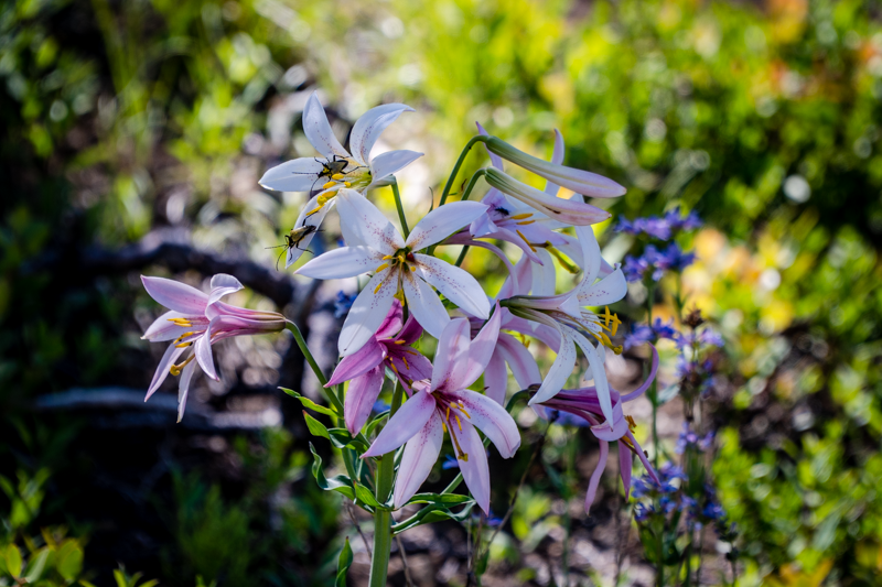
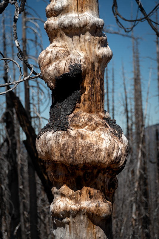
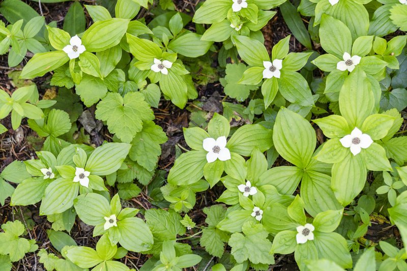
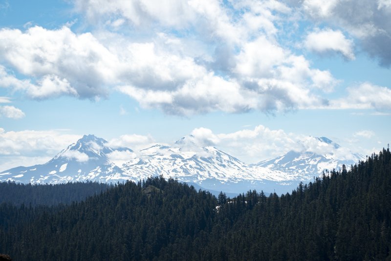
We have hiked Black Crater yearly since 2020 and although not the longest hike, it is challenging. The full hike is 7.5 miles up and back, but each hiker gains 2322 feet in the 3.75 miles up. And hiking through the burned forest from the 2017 Millie Fire can be hot and dusty during summer months. On July 15, 2022 sufficient snow had melted from the higher elevations to allow hikers to avoid slippery snow patches and reach the summit. When we arrived, we were alone at the top until we began our trip down.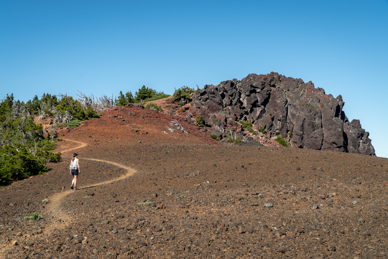 The Cascade views from the summit of Black Crater were fabulous from Broken Top to Mt. Hood. And the cold wind we have felt in earlier visits was not blowing, keeping us comfortable and able to fully enjoy the views.
It is interesting to see how certain plants have begun to reclaim the burned forest, with manzanita, fescue grass, and various wildflowers becoming more abundant each year. Young trees are beginning to grow, although it will take many decades for them to reach the heights of the trees that were killed in the fire. Ferns have regrown in some more sheltered and wetter areas of the hike; there is a certain beauty in the burned, dead trees, especially as we begin to see green undergrowth reclaiming the land.
We recommend that people planning on hiking Black Crater start early in the day before it gets warm and before crowds arrive. Allow 4.5 hours on your trip, which will provide time at the top to enjoy a snack and the views prior to returning to your car. Use your national forest parking pass and don't forget to complete and file the the free wilderness pass available at the trailhead.
 |
 |
 |
 |
12
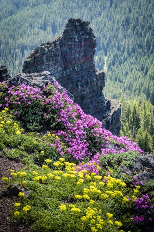
Wildflowers, Views and a Great Hike - Cone Peak Loop and Iron Mountain
Iron Mountain is a Yearly Favorite for Wildflowers
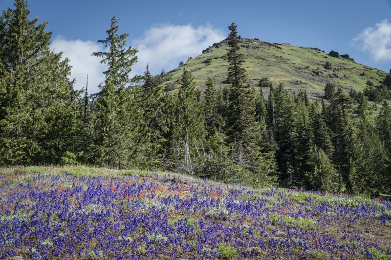
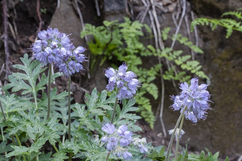
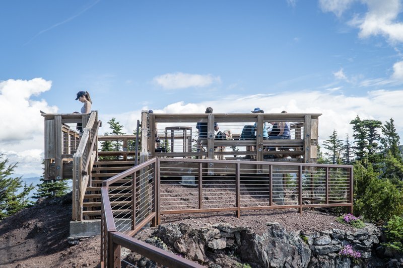
We try to hike the Cone Mountain Loop including Iron Mountain on a yearly basis, timing our hike to summer when the wildflowers are blooming. Located in the Willamette National Forest 20 miles east of Sweet Home on Hwy 20, this hike can be done multiple ways, but we opt for the longest route, parking at the Tombstone Summit parking lot (be sure to bring your National Forest Pass) and walking through the nearby nature trail and across the highway to the Cone Peak Trail. This trail switchbacks up the hillside in beautiful forest over several miles before it opens at the meadow at the base of Cone Peak which is filled with wildflowers (experts say there are over 300 varieties of blooming plants in the area). Continuing along the trail, hikers eventually leave the meadow and hike down the shoulder of the hill to the shoulder of Iron Mountain, where the trail continues up to the junction of the spur to take hikers to the top of Iron Mountain. This trail is somewhat steep with over 650 feet of elevation gain in less than a mile, but the views are fabulous and the wildflowers on the mountain stunning. At the top of the mountain is a nice, railed deck complete with mountain markers and benches for people to rest and enjoy a snack or lunch before returning down to rejoin the Cone Peak Trail to complete the loop back down across the highway and back to the Tombstone Parking lot via the Old Santiam Wagon Road. All in all, the hike is between 6.5 and 7 miles with just under 1900 feet elevation gain.
 |
 |
 |
 |
 |
 |
4
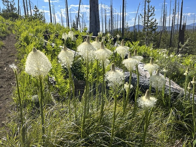
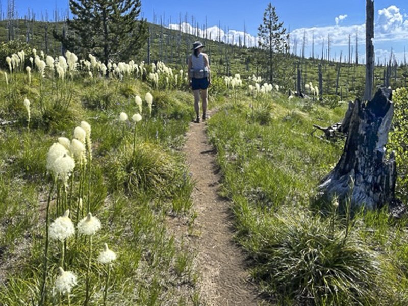
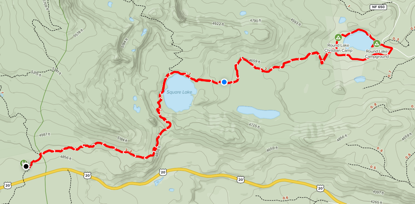
Santiam Summit to Square Lake and Round Lake Hike
Great Central Oregon Hike in the Cascades
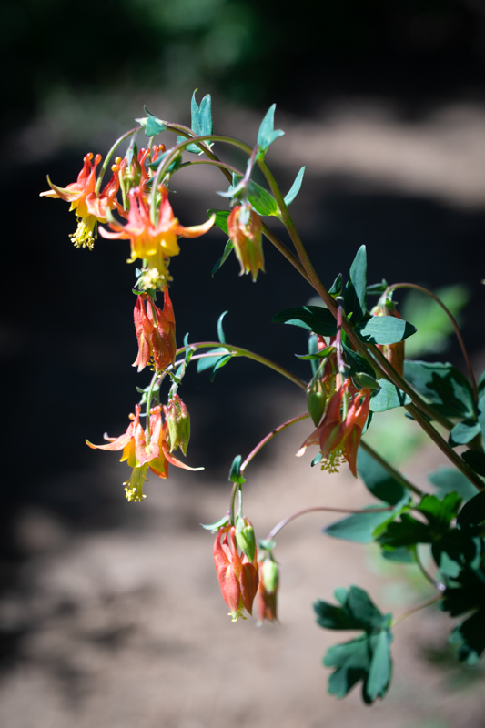
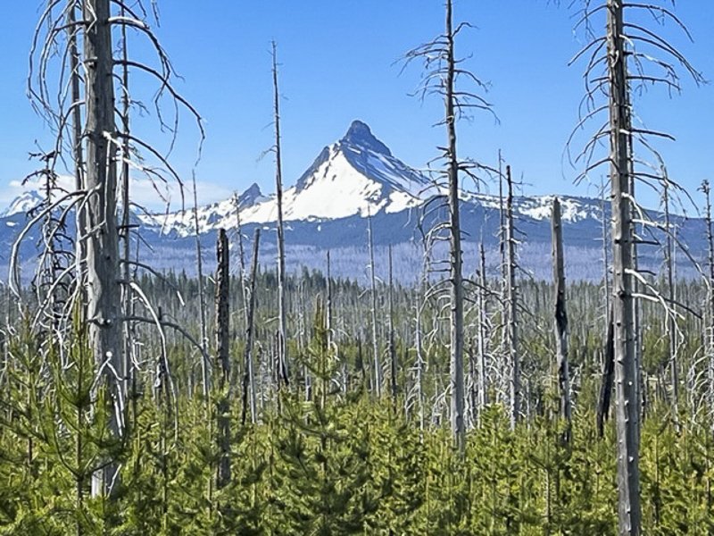
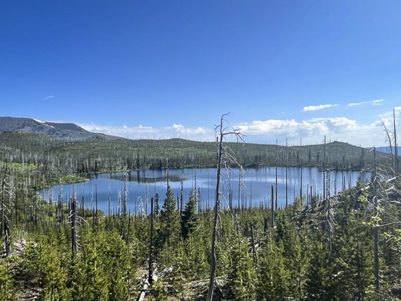
The late spring snow experienced in Central Oregon in 2022 resulted in a delayed opening of the trails in the higher elevations of the national forests and wilderness areas. But in early July, warmer temperatures have melted some of the snow and enabled hikers to access some of the lower trails. Last Saturday we hiked from Santiam Summit to Square and Round Lakes, a hike we had never done before in the Mt. Jefferson Wilderness. During this moderate 10.51 mile in and out hike we experienced 1056 feet of elevation gain - mostly easy downs to the lakes and ups out of the lake basins. The beargrass was blooming and among the most beautiful we have ever seen. The results of the 2003 90,000 acre B & B Complex fire were evident, but the blooming manzanita, lupines, and young trees were growing and reclaiming the burned land. The views of Three Fingered Jack, Mt. Washington and the Three Sisters were stunning.
When we reached Round Lake, we saw people enjoying the lake, either camping on the far shore or staying in the buildings connected with Wilderness Lakes Retreat (there is a dirt road that accesses Round Lake via Jack Lake Road). We even met and spoke with a wedding party who were planning on celebrating their event that evening. People were fly fishing, kayaking, rowing, or just floating on the calm lake. We enjoyed our lunch on the far side of the lake while we watched a bald eagle attempting to catch a fish before returning the way we came, getting back to our car before the thunderstorms began at 2 pm.
If you plan on hiking this trail, be sure to take a lot of water and wear a hat as the hike is exposed. We saw just a few people - a handful camping at Square Lake and more enjoying Round Lake, either camping or staying at the Wilderness Lakes Retreat.
 |
 |
 |
 |
For more information on Central Oregon hikes, check out our blog.
9
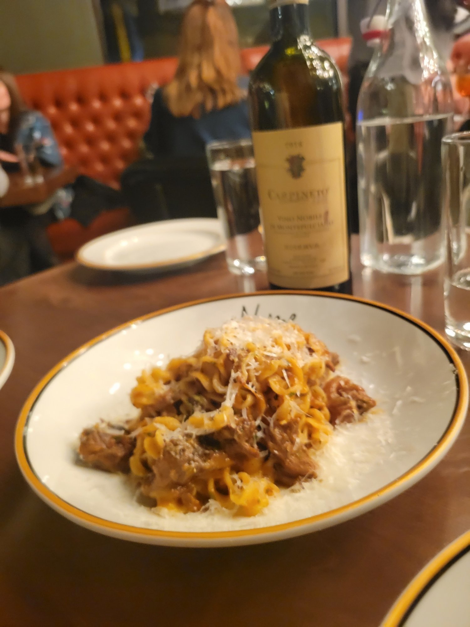
More Than Just Pasta - Bend, Oregon's Newest Italian Fare
The culinary experiences in Central Oregon never cease to amaze us. From the countless brew pubs to fine dining, there is an abundance of food options for all palates. On our most recent Bend, Oregon food experience, we ventured to the Westside to try the offerings of Nome Italiano. This new Italian restaurant did not disappoint on our ladies' night.
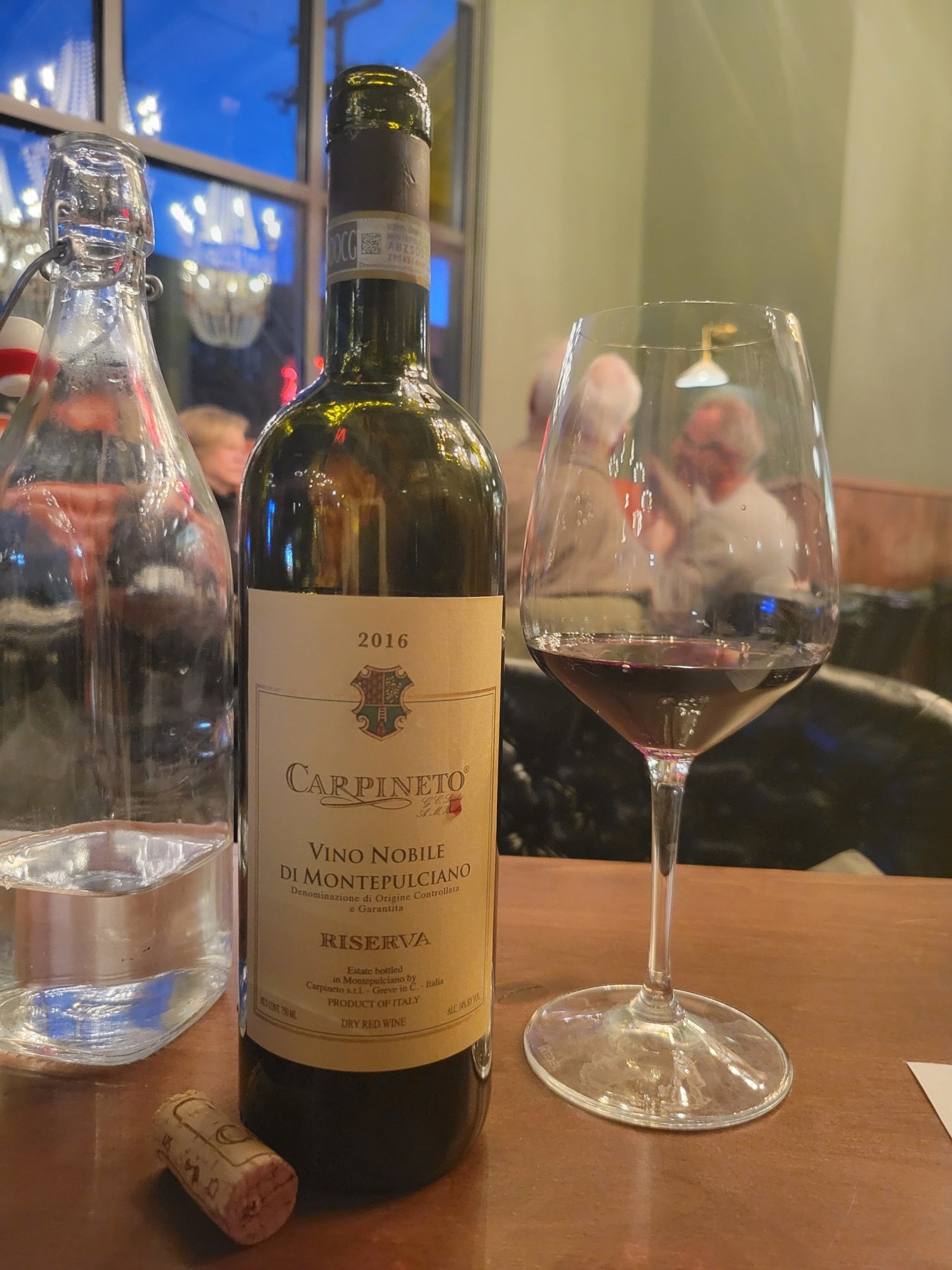 Shortly after being seated, we discovered that the front of house manager is from Tuscany, and he was more than happy to hear that we were interested in enjoying a bottle of the Vino Nobile Di Montepulciano, a varietal not as well known in Central Oregon. In fact, throughout the expansive wine list with over 100 different bottles to choose from, there was only 1 Montepulciano. Needless to say, this wine was absolutely divine and paired very nicely with the various food options we opted to share.
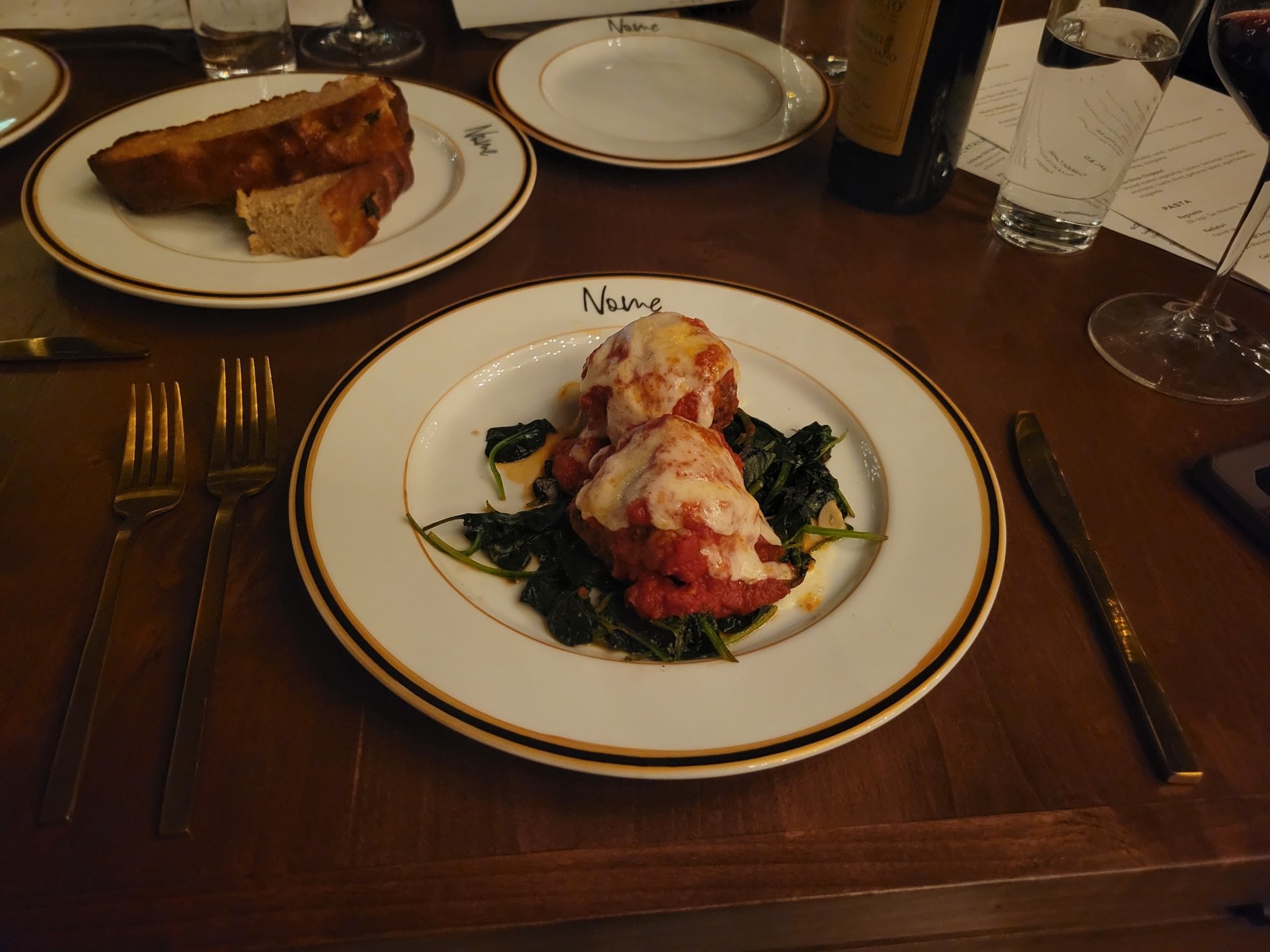
For the anitpasto options we selected the focaccia and meatballs. The focaccia was nicely crisped on the outside while still remaining soft and buttery on the inside. 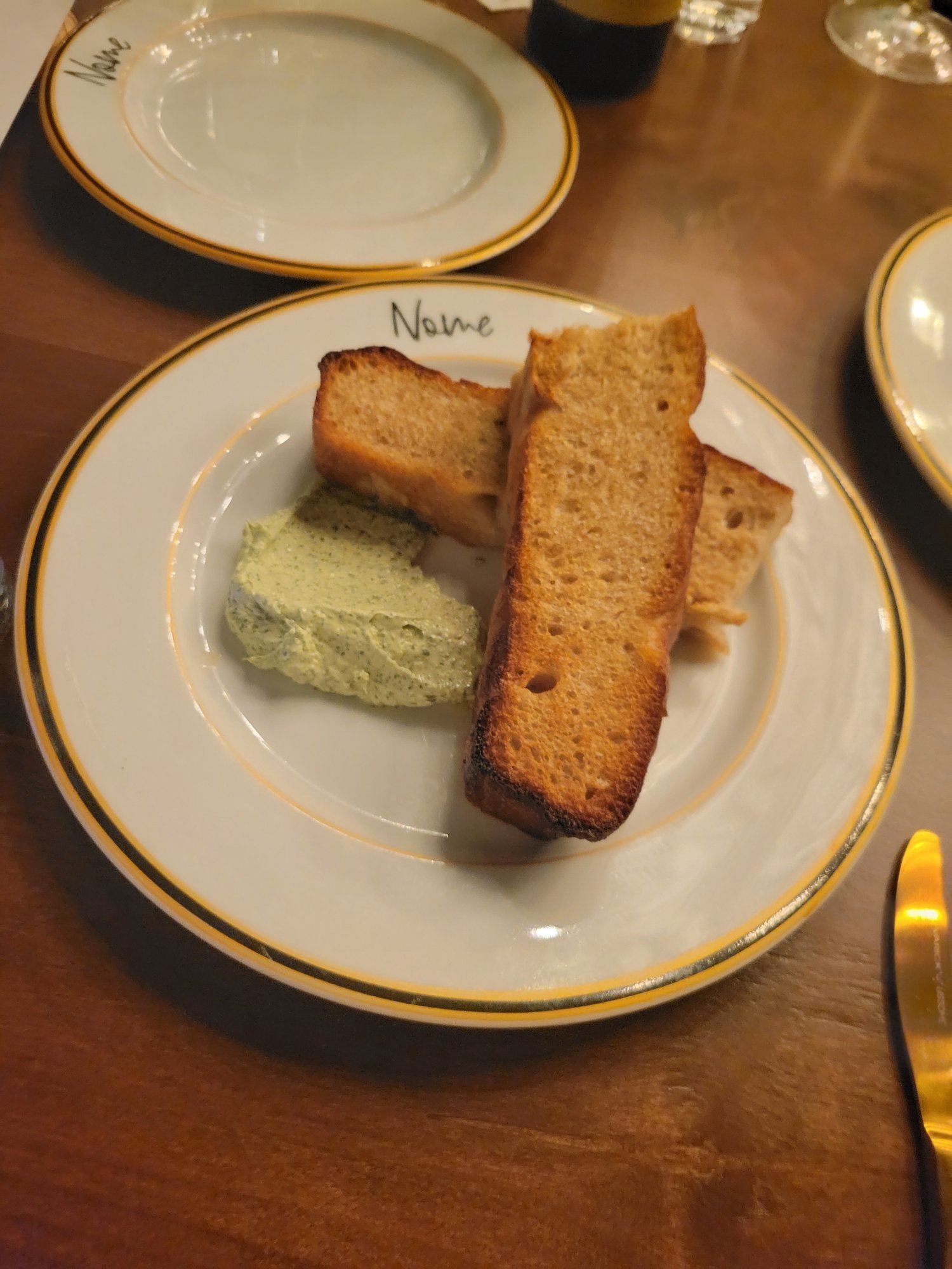 This was paired with a light, green goddess dip that was a wonderful accompaniment. The meatball plate offered two, wonderfully flavored, dense meatballs that opened up our taste buds for what the rest of the meal provided.
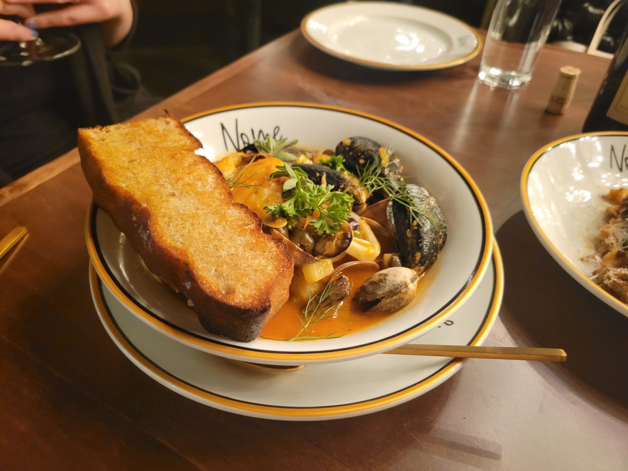
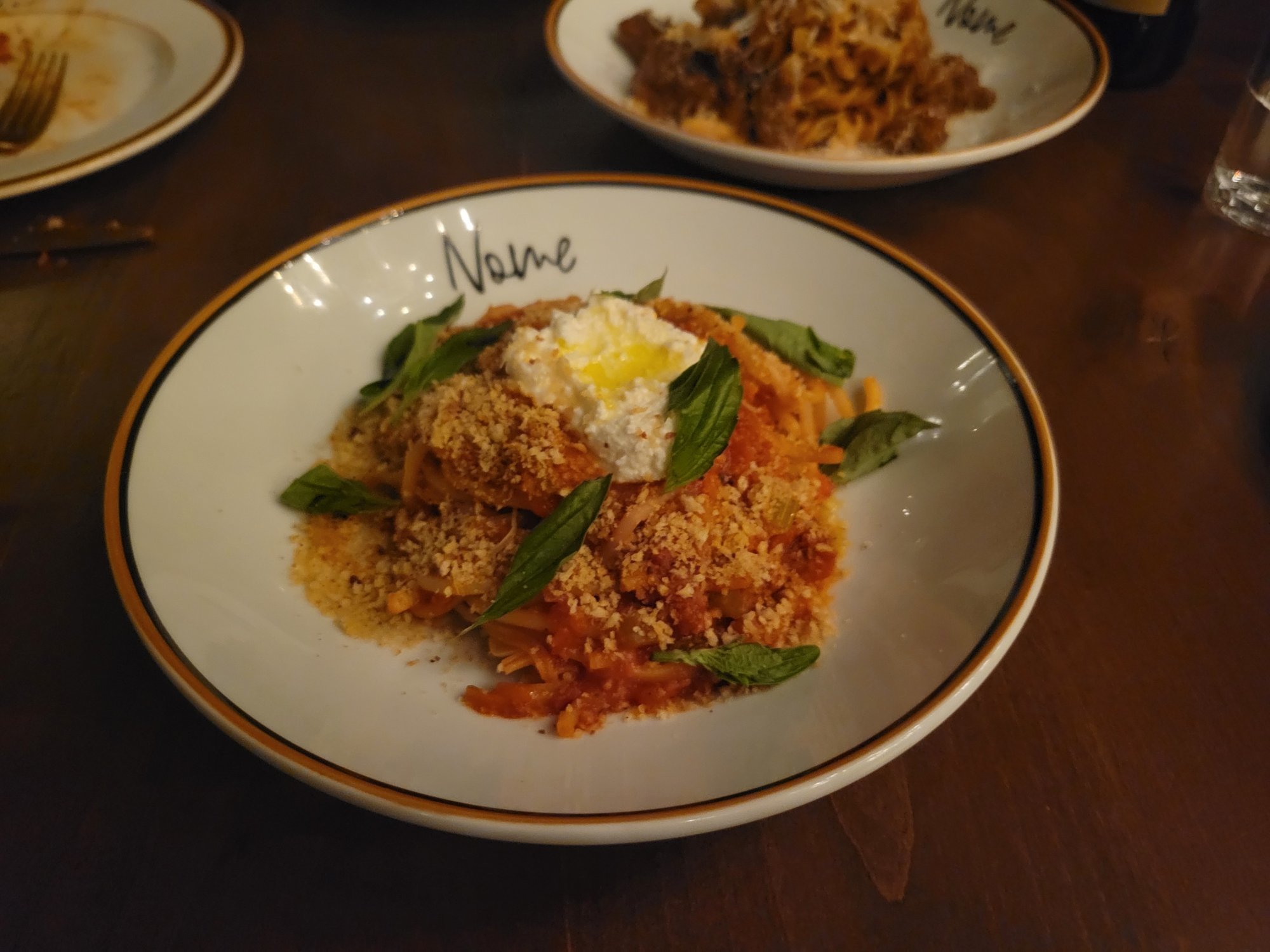
For the main courses, we decided to split three different options so we could try a little bit of everything. The Elk Ragu was really the star of the show of our main courses. This dish was extremely flavorful without being gamey at all and not overly heavy with the sauce. This is a dish we will go back for again and again. We also tried the bucatini pasta which offered a little bit of spice and some nice balance with the basil and crema on top. To finish, we tried their main seafood dish with shrimp, mussels, clams, and calamari all in a rich broth and served with a piece of focaccia. This dish was not overly fishy and the seafood was all cooked to perfection and the shrimp was absolutely exceptional.
  |
Of course, what would be a visit to an Italian restaurant without a piece of tiramisu? This desert was surprisingly light and not overly coffee forward. The waiter informed us that the dish was very lightly soaked in coffee so as to not overpower the other flavors. We appreciated every bite of this well balanced dessert. 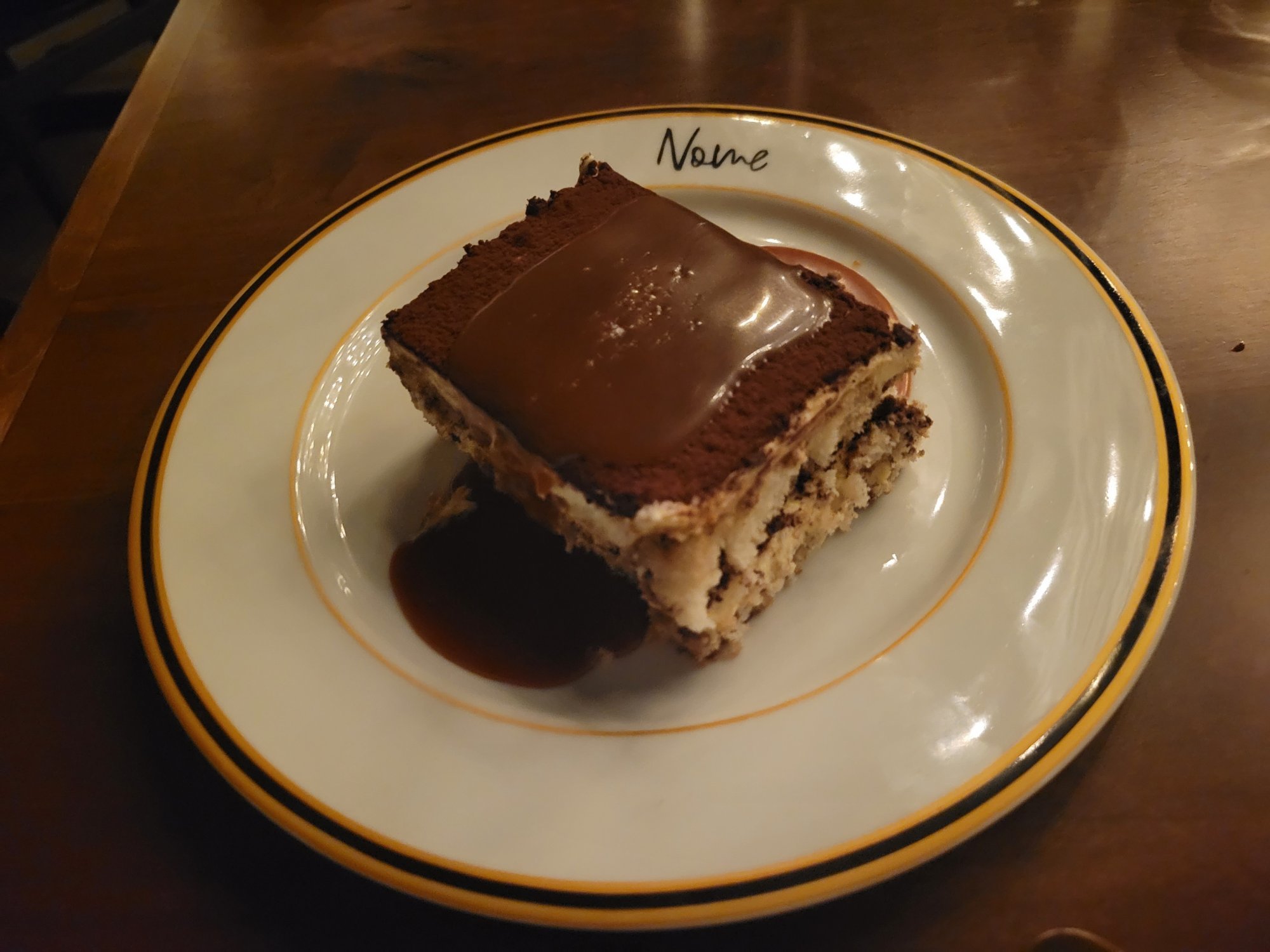
Overall impressions from our ladies' night out were so positive that we will be back to Nome in the near future. Be sure to book in advance, though, as they are starting to fill up especially at peak dining hours. Thank you Nome for the great dining experience!
-The Bend Premier Foodies
14
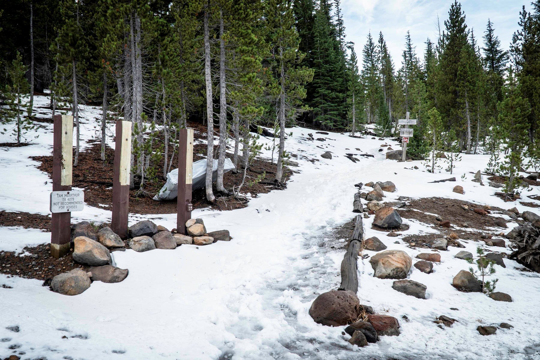
Tam McArthur Rim Trail in Snow Late Fall
One of Central Oregon's more popular summer hikes in the Three Sisters Wilderness, we decided to hike Tam McArthur Rim 11-27-21 a few days after the first snow of autumn had fallen. Three Creeks Lake had icy sections and only one other couple started the hike just a few minutes before us.
We began our hike utilizing microspikes as the trail was icy and the added gripping security microspikes offer enabled us to quickly climb the initial miles of the hike. The snow deepened as we climbed and the trail became less obvious. However, we were able to follow the tracks of the couple who started the hike just before us, trusting that they knew where they were going.
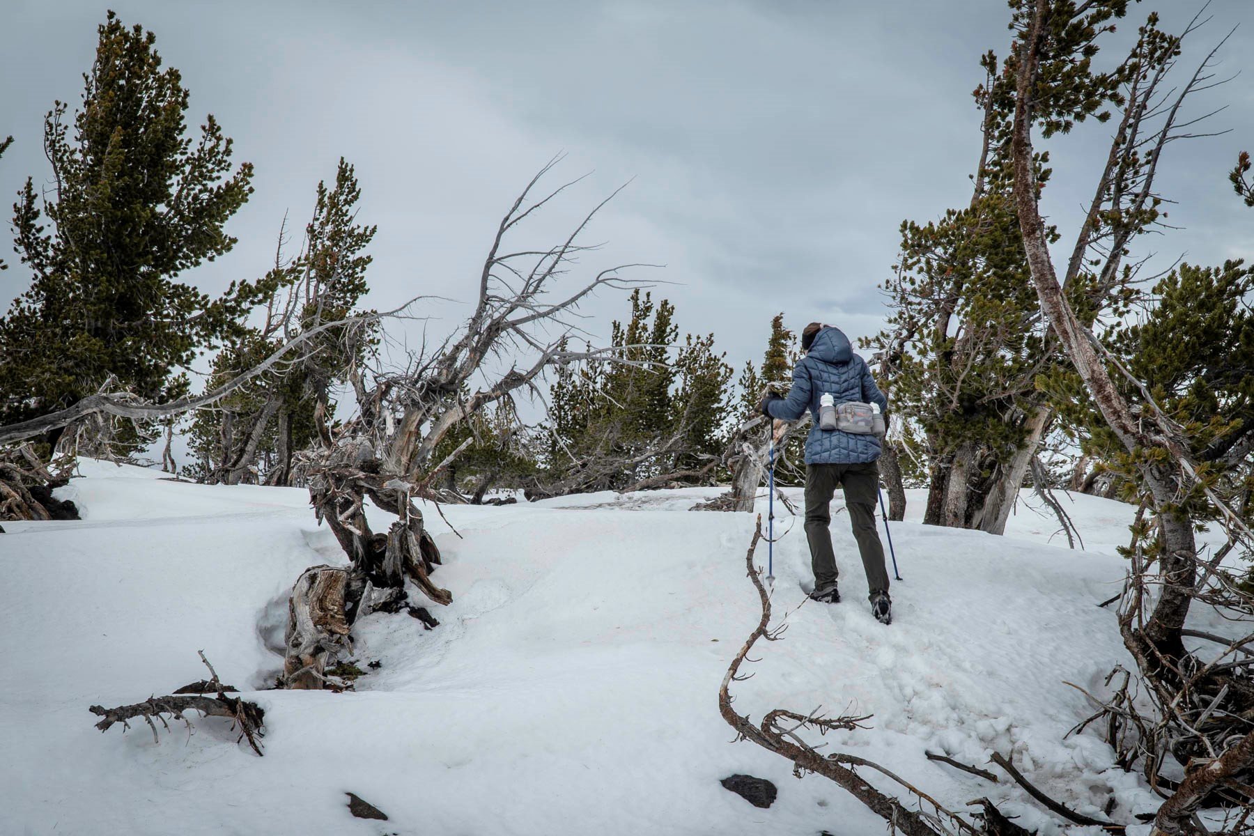
The hike to Tam McArthur Rim levels out near the summit into an open meadow. On this hike the end of November, we found the wind really picked up here. The final push to the summit was through shin deep snow and while accomplishing the destination of the hike, the cloud cover dropped and our views of the Three Sisters and Broken Top were obscured. We had hoped to take the "unofficial" trail from the Rim to Broken Hand to add additional distance and views to our hike, but with the cloud cover so low and fearful that it would start snowing again, and with no tracks to follow, we returned the way we came. On the way down we passed a few hiking parties coming up.
All in all, it was a fairly quick hike with a total of 5.3 miles in and back and 1246 feet of elevation gain. We hope to take more of these types of hikes, weather permitting, as we enter winter.
 |
 |